The brief.
The brief was a Local Spatial Development Framework for KuGqebenya. A local framework examines a particular area in more detail than a municipal-wide plan, while remaining connected to the broader spatial direction of the municipality.
A local spatial framework for KuGqebenya in Emalahleni Local Municipality, Eastern Cape.
Local Spatial Development Framework
The brief was a Local Spatial Development Framework for KuGqebenya. A local framework examines a particular area in more detail than a municipal-wide plan, while remaining connected to the broader spatial direction of the municipality.
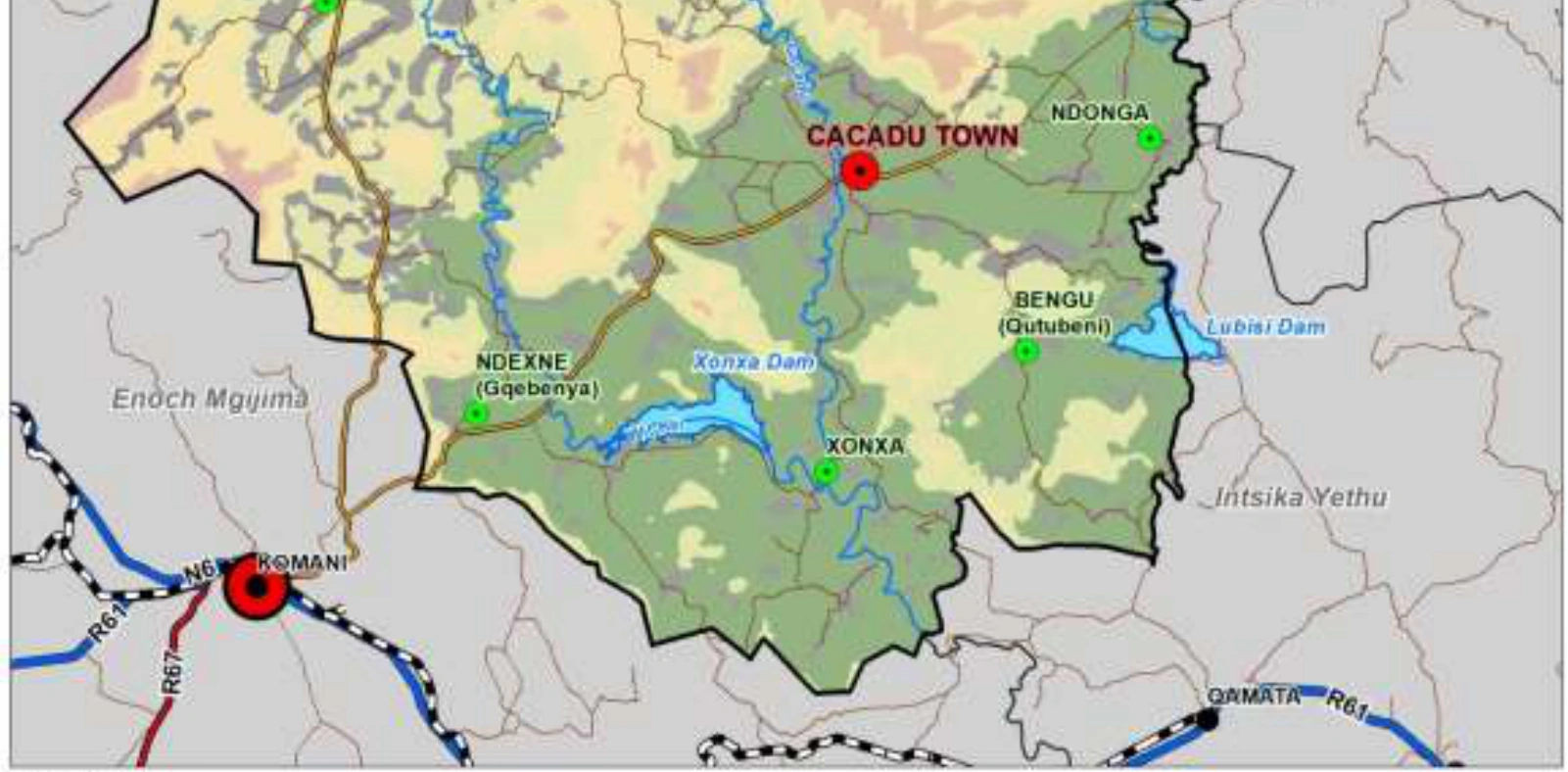
Emalahleni’s public planning documents identify Ndexne (Gqebenya) within the local development-node context. The accompanying reference map locates the area in relation to Cacadu, Xonxa Dam, nearby settlements and roads.
A local framework creates a focused basis for discussing land use, access and future development in a specific place. It helps local priorities be considered alongside the municipality’s wider planning context.