The brief.
The project brief was a Spatial Development Framework for Dr Nkosazana Dlamini Zuma Local Municipality. Its purpose is to provide a coordinated spatial picture of where development, settlement needs and land-use considerations meet.
A municipal spatial framework bringing the different places around Underberg, Himeville, Creighton and Bulwer into one planning context.
Spatial Development Framework
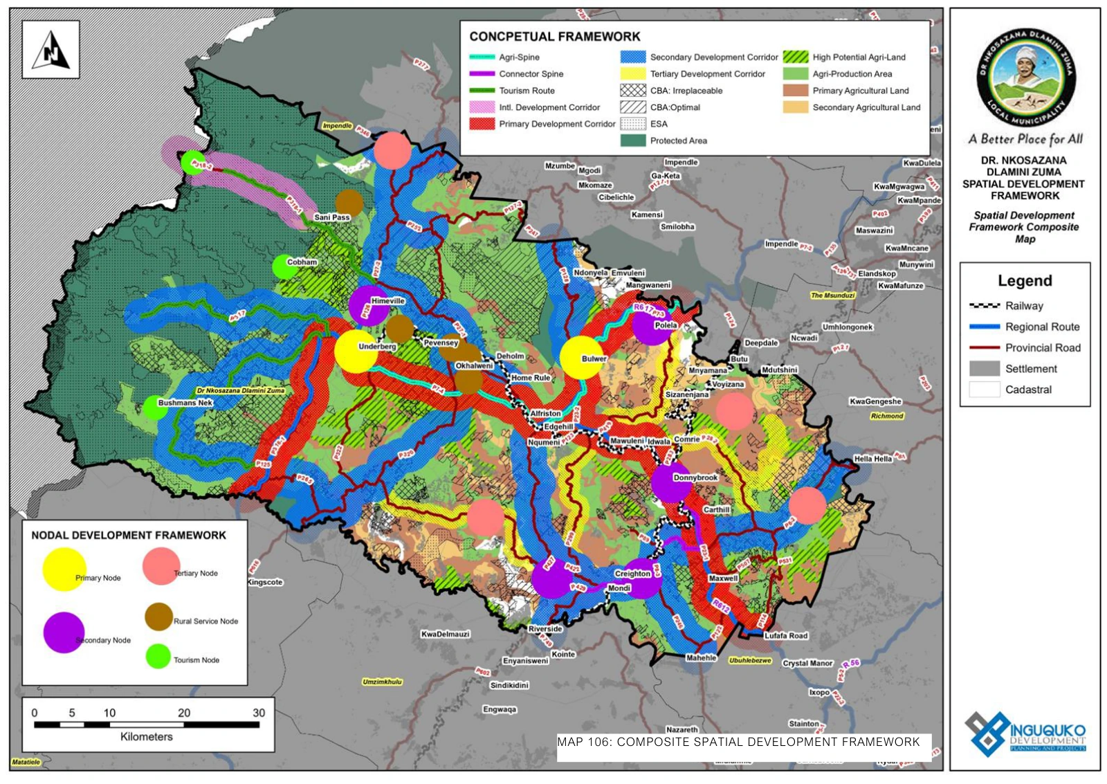
The project brief was a Spatial Development Framework for Dr Nkosazana Dlamini Zuma Local Municipality. Its purpose is to provide a coordinated spatial picture of where development, settlement needs and land-use considerations meet.
The municipality includes towns and rural areas with different development needs. The public SDF maps Underberg, Himeville, Creighton and Bulwer alongside road connections, development nodes, agricultural land and environmental areas.
A shared spatial framework helps decisions about individual places remain connected to the wider municipal picture. It provides context for considering access, land-use relationships and the long-term needs of settlements.